Dean Chris Webster & Dr Binley Chen
Other authors: Ms Miao Li; Professor Peng Gong; Professor Bing Xu
Faculty of Architecture
Division of Landscape Architecture
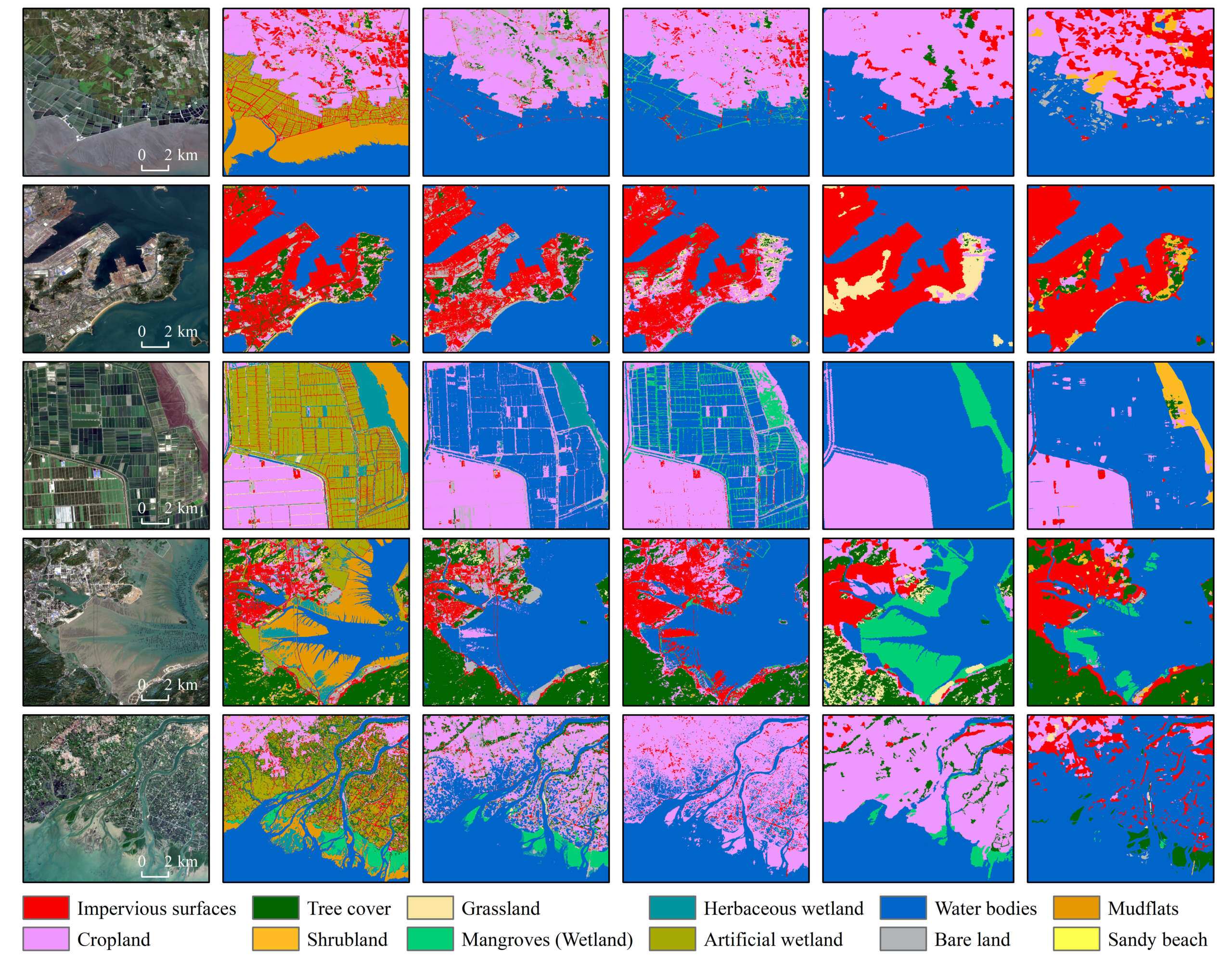
The land-sea-interface (LSI), generally referred to as coastal areas, is among the most productive ecosystems. In China, the rapid urbanisation along the coastal regions has dramatically reshaped the geomorphology, which arouses a series of environmental concerns. Multi-source and multi-scale remote sensing has enabled large-scale monitoring of the complicated and highly dynamic LSI over time. However, inconsistencies in data quality, mapping standard, modelling method, and spatiotemporal coverage of these datasets have often yielded different results, making it challenging for an accurate and comprehensive socio-ecological assessment. To address this challenge, we report a new high-resolution LSI mapping: China’s Coastal Land Covers (CCLC) at 10 meters for the year 2020. The validation results indicate that the CCLC has achieved an overall accuracy of 80%, providing comprehensive information on uncovering coastal human-natural interactions and support integrated coastal conservation and management.